Fit To Ride
Awareness of the outside world. A popular activity on foot or by bike. For the armchair traveler, surfing on LEJOG or JOGLE will turn up multiple books & blogs full of advice & descriptions. Unlike Route 66, there does not seem to be a set route. Start here. End here. Have at it.
~~~
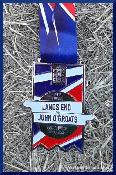
Land’s End to John O’Groats
Conqueror Challenge: Length of the UK Virtual Challenge
1,083 mile/1,743 km
Peachtree Walkers, 4 members
My Walks
From November 2, 2020 to May 26, 2021
276.4 km
15% of total
~120 walks
Longest – 5 km
Shortest – .5 km
[Walking Virtually, Land’s End to John O’Groats] IRL & virtual mileage
Vicarious Tour
Gleaned from screenshots & Internet research as we went along.

Phase one, Cornwall – Scenic. Touristy. Searches turned up endless listings for places to stay.
Phase two, England – Highway. Straight up the center of the island. So much gray.
Phase three, Scotland – Greenery. Sometimes fields but mostly a tunnel of trees. Refreshing at first but monotonous in its own way after a while. So much green.
Phase four, Scottish Highlands – Scenic. Dramatically flat with coastal cliffs. Looked like a great place to go be moody for a weekend.
[Walking Virtually, Land’s End to John O’Groats, Slideshow] Compilation of screenshots
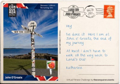
Postcards provided by Conqueror Challenge.
Previous Virtual Challenge Posts
[Virtual Kicks On Route 66]
[Virtual New Zealand, A Screenshot Slideshow] Alps to Ocean
[Biking A Steep And Stony Path] Inca Trail
[Archive] thru 2020

Stay safe. Stay sane.
Katherine

One thought on “Heading North, Walk Report, LEJOG”
Comments are closed.